

What is a Map Scale and How Does It Work?
When you glance at a map, be it a traditional paper version unfurled on a table or a digital rendition on your smartphone, you may notice a small notation or line indicating something like "1 inch equals 1 mile" or "1:100,000." This notation is known as the map scale, an essential detail that clarifies the relationship between distances depicted on the map and their real-world counterparts. In essence, the map scale represents the ratio of a distance on the map to the actual distance on the ground. This fundamental principle underpins the science of cartography, allowing you to effectively interpret and utilize maps for navigation, planning, and a variety of other tasks.
Understanding the Basics of Map Scale
Definition and Types of Map Scales
A map scale is fundamentally the ratio of a distance on the map to the corresponding distance on the ground. This ratio can be expressed in several ways, each serving a different purpose and user need. There are three primary types of map scales: fractional or ratio scales, linear scales, and verbal scales.
A fractional or ratio scale uses a representative fraction to indicate the scale. For example, a scale of 1:100,000 means that 1 unit on the map represents 100,000 units in real life. This type of scale is often used for its precision and clarity.
A linear scale, also known as a bar scale, is a visual representation of the scale. It consists of a series of lines or marks that indicate the distances on the map. This scale is useful for quick measurements and is commonly found on topographic maps.
A verbal scale uses simple language to describe the relationship between the map and real-world distances. For instance, "one inch to the mile" is a verbal scale that tells the user that one inch on the map equals one mile in real life. This type of scale is straightforward and easy to understand.
Importance of Map Scales in Cartography
Map scales are essential in cartography for several reasons. First and foremost, they ensure accuracy in interpreting distances and sizes of features on the map. Without a scale, it would be impossible to determine the actual size or distance of geographical features, leading to potential errors in navigation, planning, and analysis.
Map scales also provide consistency across different maps. By using standardized scales, cartographers can ensure that maps are comparable and that the information presented is reliable and uniform. This consistency is vital for tasks such as urban planning, geological surveys, and navigation.
In addition, map scales determine the information density of a map. The choice of scale affects how much detail can be shown on a map of a given size. For example, a large-scale map can show detailed features such as individual buildings and streets, while a small-scale map might only show major roads and landmarks.
Map scales also facilitate geographical analysis by allowing users to measure and calculate various variables on the map. This is essential for understanding the relationships between different geographical features and for making informed decisions based on the data presented on the map.
Finally, map scales play a significant role in education and communication. They help users understand the geographical intricacies of an area and ensure that the information is conveyed clearly and accurately. This is particularly important for tourists, researchers, and anyone who needs to interpret and use maps effectively.
How Map Scales Function in Different Types of Maps
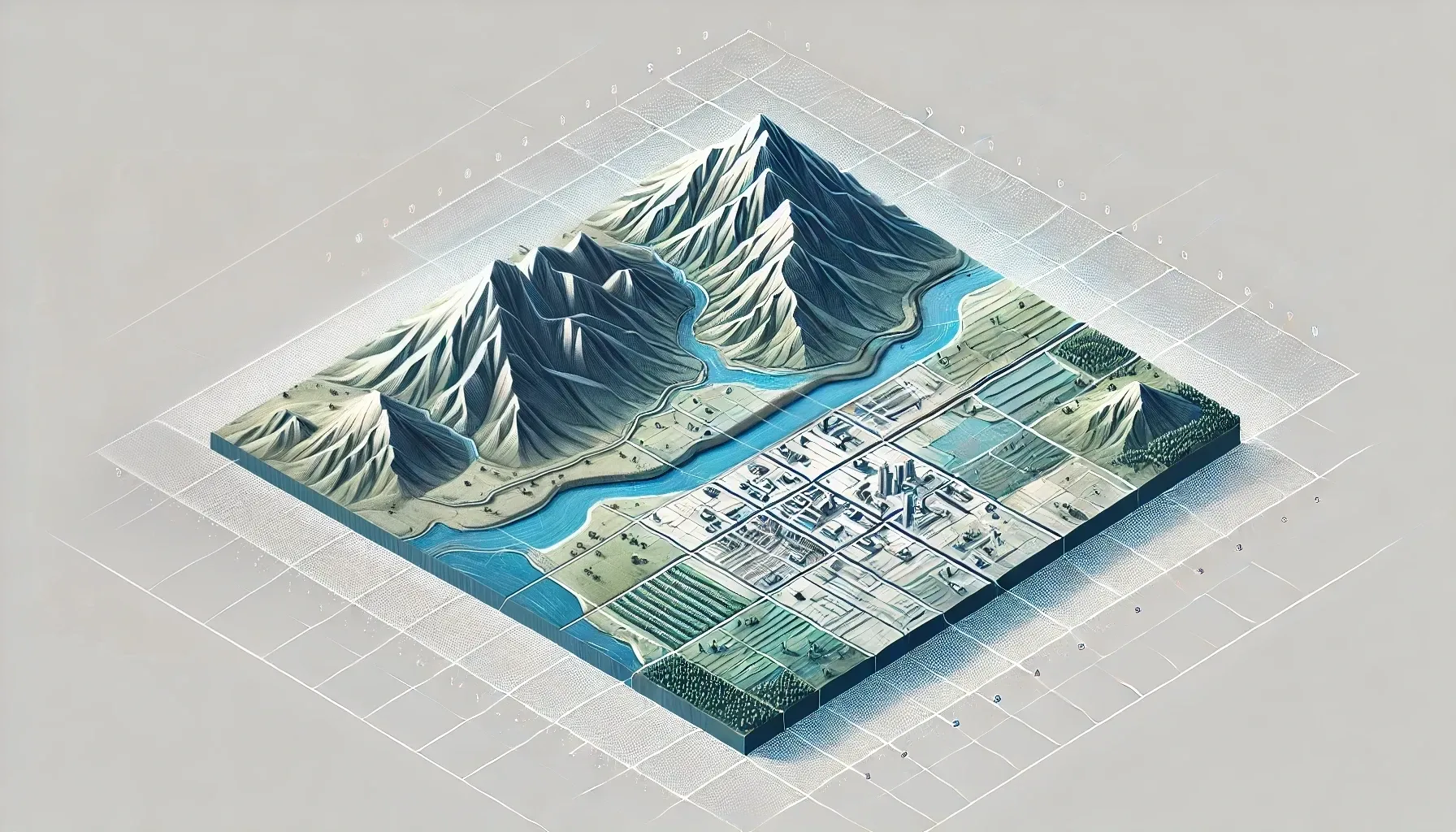
When discussing map scales, it is essential to understand the distinction between large scale and small scale maps. This distinction is often a source of confusion, as the terms 'large' and 'small' do not refer to the physical size of the map, but rather to the level of detail and the area covered.
A large scale map shows a smaller geographic area but with a higher level of detail. For example, a town plan or a hiking map might be on a scale of 1:10,000 or 1:25,000. These maps are called large scale because the representative fraction is relatively large, meaning that the objects on the map are drawn at a larger proportion of their actual size.
This results in more detailed representations of features such as buildings, roads, and topographic details.
On the other hand, a small scale map covers a larger geographic area but with less detail. World maps, continent maps, or maps of large nations are examples of small scale maps.
These maps have a smaller representative fraction, such as 1:100,000,000, indicating that the objects on the map are drawn at a much smaller proportion of their actual size. Small scale maps are useful for showing broad patterns and relationships over large areas but lack the detailed information found on large scale maps.
Another critical aspect of map scales is the variation in scale across the map. Due to the Earth's curvature, it is impossible to represent the Earth's surface on a flat map without some degree of distortion. This distortion affects the scale of the map, particularly in maps that cover large areas.
The nominal scale or representative fraction stated on a map is an average scale and does not account for the variations that occur due to the map projection. For instance, the Mercator projection, commonly used for navigation, has a scale that varies significantly with latitude. At the equator, the scale is accurate, but it becomes increasingly distorted as you move towards the poles.
Map projections play a significant role in how scale varies across a map. Different projections distribute the distortion differently, and some projections, like the transverse Mercator, are designed to minimize distortion within specific regions.
Understanding these variations is essential for accurate measurements and interpretations, especially in maps covering extensive areas.
Applying Map Scales in Real-World Scenarios
In real-world scenarios, map scales play a vital role in navigation and geographic analysis. For instance, in navigation, understanding the map scale is essential for estimating distances and travel times. Whether you are using a physical map or a digital one, the scale helps you determine how far apart locations are and how long it will take to travel between them.
This is particularly important for hikers, drivers, and anyone planning a route, as it allows them to make informed decisions about their journey.
In geographic analysis, map scales are essential for measuring and analyzing various variables. For example, in epidemiological studies, different scales can reveal different patterns of disease distribution.
By using maps at various scales (e.g., county, ZIP code, or census tract levels), researchers can identify hotspots and trends that might not be apparent at a single scale. This multi-scale approach enhances the accuracy and depth of the analysis.
Map scales also facilitate the estimation of time and resources needed for projects. By accurately measuring distances and areas on a map, planners can estimate the time required for tasks such as construction, emergency response, or environmental surveys.
This helps in resource allocation and scheduling, ensuring that projects are managed efficiently.
Digital mapping tools have revolutionized the way we apply map scales in real-world scenarios. Tools like ArcGIS Pro, QGIS, and Google Earth offer robust functionalities for working with map scales. These tools allow users to set dynamic scales, create scale bars, and adjust measurements in real-time, ensuring high accuracy and precision in mapping projects.
Smartphone apps such as Map Measure and Measure Map utilize GPS and map data to provide on-the-go scale calculations. These apps are invaluable for fieldwork, where immediate access to scale tools is essential. They enable users to measure distances, calculate areas, and estimate scales directly from their mobile devices, enhancing the efficiency of field operations.
GIS software also enables the creation of scale-dependent databases, where data is displayed based on the current scale of the map. For example, on a world map, you might only show major cities, but as you zoom in to a regional or local scale, more detailed data such as smaller urban centers or individual landmarks can be visualized.
This feature helps in managing data clutter and ensures that the map remains clear and informative at any scale.
Moreover, digital tools facilitate the maintenance of consistent scale representation across different maps. By using templates and standardized scales, users can ensure that their maps adhere to industry standards, reducing errors and improving the overall accuracy of the mapping project.
Conclusion
In conclusion, understanding map scale is a fundamental skill in cartography and geography, enabling accurate interpretation and use of maps. Remember that map scale is the ratio between distances on the map and actual distances on the Earth’s surface, influencing how we perceive distances, areas, and features.
Large scale maps provide detailed representations of smaller areas, while small scale maps cover larger areas with less detail. Understanding map scales is essential for navigation, geographic analysis, and decision-making, as it ensures accuracy in measuring distances and calculating areas.
By mastering map scales, you can leverage maps effectively in various fields, from urban planning to environmental monitoring. Always consider the scale when interpreting maps to make informed decisions and avoid errors. With this knowledge, you can navigate, analyze, and communicate geographical information with confidence and precision.
FAQ
What is a scale in a map?
A scale in a map is the ratio of a distance on the map to the corresponding distance on the ground. It is often expressed as a representative fraction (e.g., 1:100,000), indicating that 1 unit on the map represents 100,000 units in real life.
How do you explain a map scale to a child?
A map scale is like a special ruler on a map that helps you understand how big or small things are in real life. For example, if a map says 1 inch equals 100 miles, it means that every inch on the map represents 100 miles in the real world.
This helps you measure distances and know how far apart places are.
What does the scale on a map tell the reader?
The scale on a map tells the reader the ratio of a distance on the map to the corresponding distance on the ground, allowing them to measure and understand the relationship between the mapped area and the actual geographic area it represents.
What does a map scale of 1 to 25,000 mean?
A map scale of 1:25,000 means that every 1 centimeter on the map represents 25,000 centimeters (or 250 meters) in real life. For example, 4cm on the map equals 1km in real life.
About Woosmap
Woosmap empowers businesses to optimize Location Services and Intelligence with precision and efficiency. By leveraging advanced geolocation, Store Locator, and Map API tools, Woosmap ensures accurate deliveries, streamlines address entry processes, and enhances customer satisfaction. With a strong commitment to privacy, Woosmap delivers innovative, GDPR-compliant solutions that do not collect personal data, making it a trusted partner for companies prioritizing both performance and user trust.