Travel Time Map Insights: Optimize Your Commute & Journeys
Introduction: Understanding the Value of Travel Time Maps
Ever wondered how long it will actually take to get from point A to B, beyond just the miles? That's where the charm of travel time maps comes in, especially when straight-line distance doesn't paint the full picture of real-world complexities like traffic jams, winding roads, or the choice between pedaling a bike and speeding in a car.
Travel time maps, or as the cool kids say, isochrone maps, transform your travel planning into an efficient, stress-free adventure. Tools like Smappen and TravelTime allow you to craft these visual guides, taking into account everything from speed limits to traffic, to whether you’re hoofing it, cycling, or driving. The beauty of it? These maps give you the power to make smart, informed travel decisions, making them essential for commuters, entrepreneurs, and urban planners alike.
The true magic of travel time maps? They’re a treasure trove of insights, helping you discover the perfect spot for your new home or business by highlighting reachable areas within your preferred travel time. It's not just about saving time; it's about dialing down the commute-induced stress and unlocking a smoother, more predictable journey ahead.
As we dive into the nitty-gritty science behind these revolutionary tools and their real-world applications, get ready to reimagine the efficiency of your daily commutes and travel plans.
The Science Behind Travel Time Maps
What is a Travel Time Map?
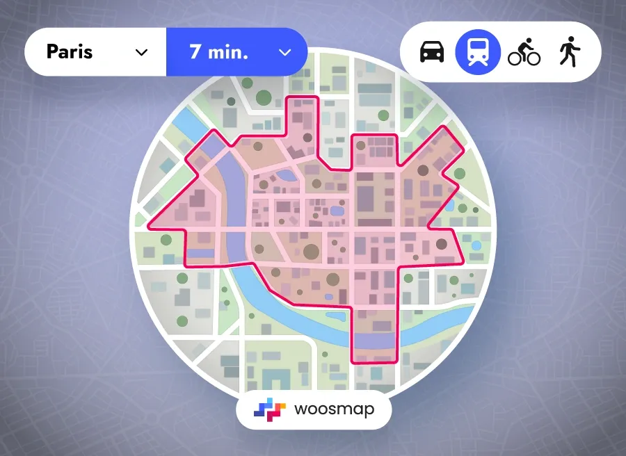
Ever wondered how you can figure out all the places you can reach within, let’s say, 30 minutes, whether by foot, bike, car, or public transport? That’s what a travel time map, or as the geeks call it, an isochrone map, does for you. It’s not about how far, but how fast you can get there, considering real-life obstacles like traffic jams, road closures, and whether you’re cycling up a hill or strolling on flat ground. This handy tool turns complex data into a simple answer to the question: "Where can I get to in X minutes?" making it a traveler’s best friend for smart planning.
Technological Foundations of Modern Travel Time Maps
The magic behind today’s travel time maps boils down to a mix of cutting-edge algorithms and the wonders of APIs, like those whipped up by TravelTime. These digital wizards can conjure up thousands of isochrones tailored to your mode of transport—be it pedaling away on a bike or catching the next subway—using inputs such as your start point, how long you’re willing to travel, and when you’re setting off, to calculate those invisible boundaries of possibility.
Dressed in a JSON format, this data includes coordinates that sketch the perimeter of where you can venture. But wait—there’s more! In comes the power of real-time and historical traffic intel, combined with brainy spatial discretization tricks (think quadkeys or honeycomb-like hexagons) that make it a breeze to estimate how fast you’ll move in the current traffic scene or based on past trends.
For example, by breaking down your journey into a grid of intersecting tiles using quadkeys, these systems can pull average speed data for each part of your path, making for a smoother ride or stride. And let’s not forget about those cost or friction surfaces—these clever constructs calculate the time it takes to cover every inch of your route, accounting for roads, paths, and various geographic features. It’s a comprehensive approach that paints a picture of your journey’s time cost, with all the twists and turns of real-world travel.
Last but not least, bringing travel time maps to life involves some serious geospatial gymnastics. Tools like the Temporal Distance Mapping tool twist and stretch conventional maps to visually echo travel times instead of just distances. This genius twist gives you a fresh perspective, making it easier to digest travel times at a glance. It’s like seeing the world through a lens that zooms in on time, not just space.
Practical Applications: Enhancing Your Daily Commute
Customizing Maps for Personal Commutes
Ever found travel time maps just a tool for businesses? Think again. These navigational gems can significantly enhance your personal daily commute, transforming it into a more efficient and less stressful journey.
With tools like Smappen or the TravelTime map tool, personalizing your commute becomes a breeze. You can create drive time maps tailored to your specific needs, whether you’re behind the wheel, on foot, pedaling away, or hopping on public transport.
By setting your starting point—like home or the office—and defining your ideal travel time, you unlock the power to see precisely which areas are within reach. Imagine knowing every possible stop or detour you could take on a 30-minute commute. That’s customized commuting at its finest.
Adjusting Routes in Real-time
But the real magic happens with the ability to tweak routes on-the-fly, catering to current traffic conditions.
Champions of the commute, such as Google Maps and Waze, integrate live traffic data to keep your journey as accurate and current as possible. Stuck in an unforeseen jam? These tools reroute you in real time, dodging the gridlock and shaving valuable minutes off your estimated arrival time. This is how you beat the traffic blues.
Not to be outdone, apps like Citymapper and Transit keep public transport users in the loop with up-to-the-minute updates. For city dwellers, this feature is a goldmine, ensuring you can glide through the most efficient public routes and sidestep any unwanted travel surprises. Efficiency and ease, right in your pocket.
Extending Beyond the Commute: Planning Efficient Journeys
Long-Distance Travel and Time Mapping
While travel time maps are incredibly useful for daily commutes, their applications extend far beyond local travel.
When planning long-distance trips, whether for business or leisure, these maps can be indispensable. By using tools like TravelTime or Smappen, you can create detailed travel time maps that show the areas you can reach within a specified time frame, even over long distances.
For instance, if you are planning a road trip, you can generate a drive time map to identify the best stops and rest areas along your route. This helps in breaking down the journey into manageable segments, ensuring you don’t overextend yourself and can plan for rest, food, and other necessities.
Additionally, these maps can account for traffic conditions, road types, and other factors that might affect your travel time, making your long-distance travel more predictable and stress-free.
In the context of business travel, travel time maps can help in optimizing routes for sales teams or delivery services. By identifying the most efficient travel times and routes, businesses can reduce travel costs, improve customer service, and enhance overall operational efficiency. For example, logistics companies can use these maps to determine the best locations for warehouses and distribution centers, ensuring that goods can be delivered quickly and reliably.
Integrating Local Attractions and Stops
Travel time maps are not just about getting from point A to point B; they can also help you plan your journey by integrating local attractions and stops.
When using platforms like Geoapify or TravelTime, you can search for points of interest within your travel time area. This feature is particularly useful for tourists who want to explore new areas efficiently.
For example, if you are planning a vacation, you can create a travel time map around your accommodation to see which tourist attractions, restaurants, and other amenities are within a reasonable travel time. This helps in planning day trips and ensuring that you make the most of your time without wasting hours on unnecessary travel.
Additionally, businesses in the tourism sector can use these maps to provide their customers with personalized travel plans, highlighting nearby attractions and services that fit within their travel time constraints.
Moreover, integrating local stops into your travel plan can make your journey more enjoyable and convenient. Whether it’s finding the nearest hospital, shopping center, or public transport hub, travel time maps provide a comprehensive view of what is accessible within your specified travel time. This level of detail ensures that you are well-prepared for any situation that may arise during your journey, making your travel experience smoother and more enjoyable.
Business Applications: Elevating Efficiency with Travel Time Maps
Travel time maps don’t just benefit individuals—they’re game-changers for businesses, too. Companies across sectors use these maps to improve delivery logistics, optimize store locations, and streamline customer access. For example, travel time insights help companies make data-driven decisions about warehouse locations or service areas, minimizing costs and enhancing customer satisfaction.
Solutions like Woosmap further empower businesses with real-time travel data, transforming complex location analytics into clear, actionable insights that drive smarter operations.
Conclusion: Travel Smarter with Time Map Insights
In conclusion, travel time maps are a powerful tool for optimizing your commutes and journeys.
By leveraging these maps, you can gain valuable insights into travel times, routes, and accessible areas, making your travel more efficient and stress-free. Whether you're planning a daily commute, a long-distance trip, or evaluating new office or store locations, travel time data provides essential information to inform your decisions. Utilize tools like Google Maps, TravelTime, and other geospatial technologies to create personalized itineraries, adjust routes in real-time, and integrate local attractions and stops.
Embrace the potential of travel time maps to enhance your travel experience and make the most of your time on the move.
FAQ
How to do travel time on Google Maps?
Ever wanted to scope out how far you can roam on Google Maps within a set time frame? Dive into the "Layers" menu, click "More," and voilà—select "Travel Time" under the "Map tools" section. This nifty trick is your go-to on the browser version, though it's yet to hit the mobile app stage. Whether you're plotting your path on foot or by car, the map will show your potential reach with a cool blue zone.
What is a map that shows how far you can travel in time?
Picture this: a map that spells out exactly how far your adventures can take you, over various timespans and transport modes. That's a travel time map, or an isochrone map. It’s your ultimate tool for visualizing reachable distances from any given start point within your choice of duration. Whether you’re pedaling, walking, taking public transport, or cruising in your car, this map's got your back.
How can Woosmap's Distance Isochrone API support businesses using travel time maps?
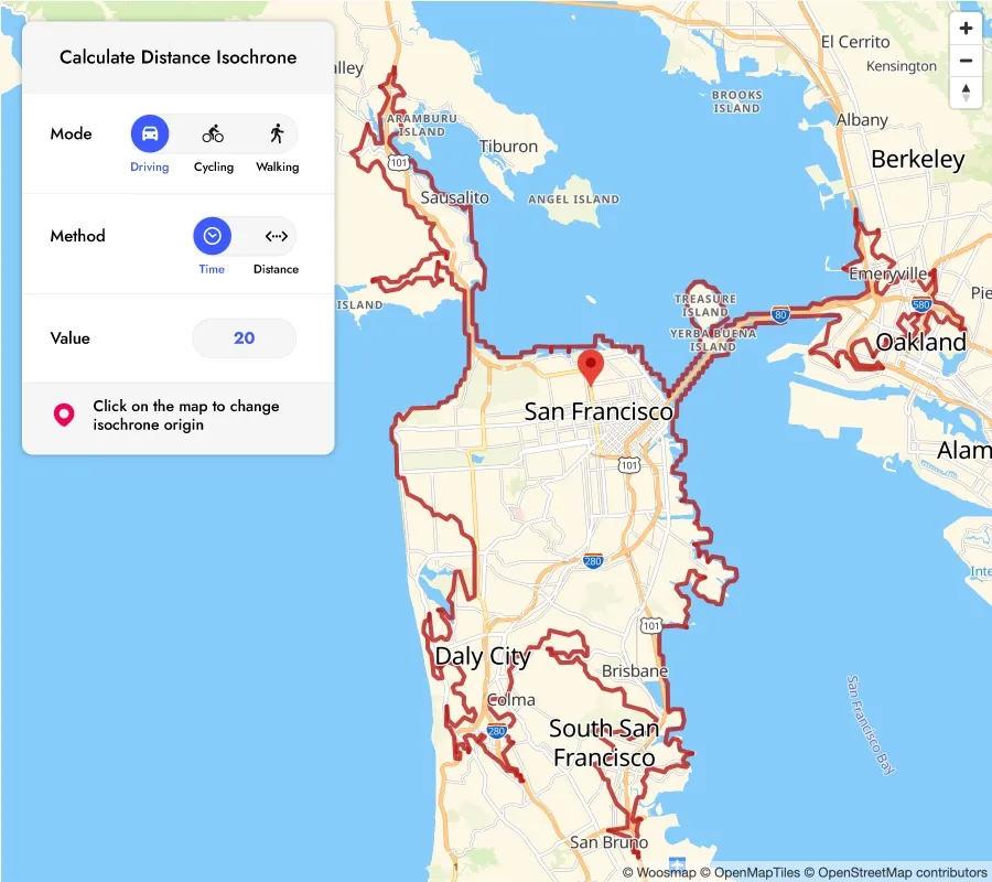
Woosmap's Distance Isochrone API enables companies to create precise travel time maps for various transport modes. By defining reachable areas within specific time limits, businesses can optimize delivery zones, customer access, and location-based strategies, all based on real-world travel conditions.
What advantages does the Woosmap Isochrone API offer for B2B logistics and planning?
Woosmap’s Isochrone API provides dynamic, data-rich isochrones that help businesses visualize service areas, plan efficient routes, and improve logistics by integrating accurate travel times, helping companies make informed decisions with real-time and historical data.
Does Google Maps do time zones?
Curious if Google Maps can keep up with the world's ticking time zones? Yes, it sure can! By leveraging tools like the Time Zone API or maps that overlay those time zone boundaries, you can easily navigate the temporal landscapes of various locations.
Can you do a drive-time radius on Google Maps?
Looking to draw a circle around your destination based on how long you're willing to drive? Well, Google Maps might not have this feature baked in, but don't fret! There's a world of third-party tools waiting for you. From the TravelTime API to specialized websites mentioned in the map tools section, you'll find just the right gadget to chart your drive-time radius.
About Woosmap
Woosmap empowers businesses to optimize Location Services and Intelligence with precision and efficiency. By leveraging advanced geolocation, Store Locator, and Map API tools, Woosmap ensures accurate deliveries, streamlines address entry processes, and enhances customer satisfaction. With a strong commitment to privacy, Woosmap delivers innovative, GDPR-compliant solutions that do not collect personal data, making it a trusted partner for companies prioritizing both performance and user trust.

